Overview
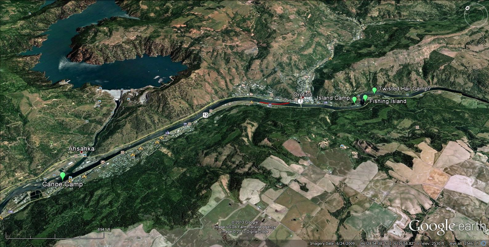
Figure 1. Bird's Eye view of the Orofino area. Full-size image
The Corps of Discovery first entered the Orofino area when Capt. Clark accompanied by three expedition members arrived late in the evening of September 21, 1805 at Twisted Hair’s camp just up river from Orofino. The next day they returned to Weippe area and then returned with the whole expedition on the 24th. By the 25th many men were sick. Clark, with Chief Twisted Hair and two young Nez Perce men headed down river to hunt trees “Calculated to build Canoes.” They traveled down the north side of the river to mouth of the North Fork.
They then crossed the river and returned to Twisted Hair’s village above today’s Orofino. On Sept 26 the entire Corps of Discovery traveled down the river to what today we call Canoe Camp where they built the canoes used on the remainder of their trip west. On October 7th they left the area when they departed down river in the new canoes. They had limited contact in the area in the spring of 1806. Let’s look at each of those sites a little more closely.
Twisted Hair's 1805 Camp
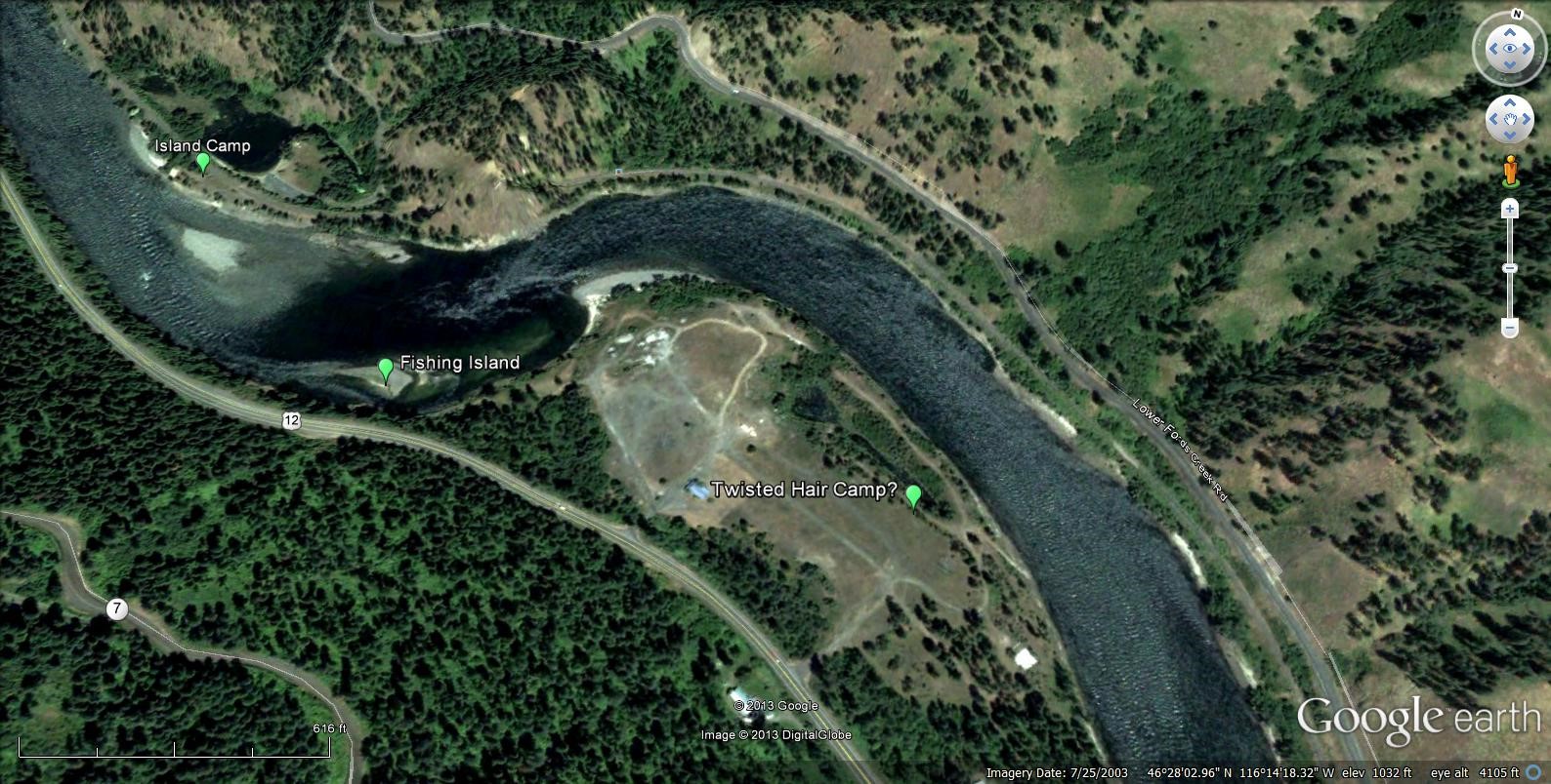
Figure 2. Chief Twisted Hair's village site. Full-size image
Twisted Hair’s camp area was just ¼ mile upstream from Orofino on an island that is now part of the southern bank of the Clearwater River, see Figure 2. The area has been modified quite a bit as it was the site of a lumber mill and other activities during the first three-fourths of the 20th century.
When Clark arrived he had to wait for Twisted Hair to come from a fishing island, which was probably the small island below the village site. This can be confusing as to which journal entry you read. Some reason that Twisted Hair’s camp was on the north side of the river and when Clark arrived he came from his village on an island. Others (including this writer) think that Clark & guide must have crossed to village site when it was an island and then the guide called to Twisted Hair who was fishing on a smaller island. When the whole expedition arrived a few days later they camped downstream on an island on the north side of the river. That island has since been connected to the north bank by the railroad that built through the area in the late 1890s.
Upriver from Twisted Hair's Camp
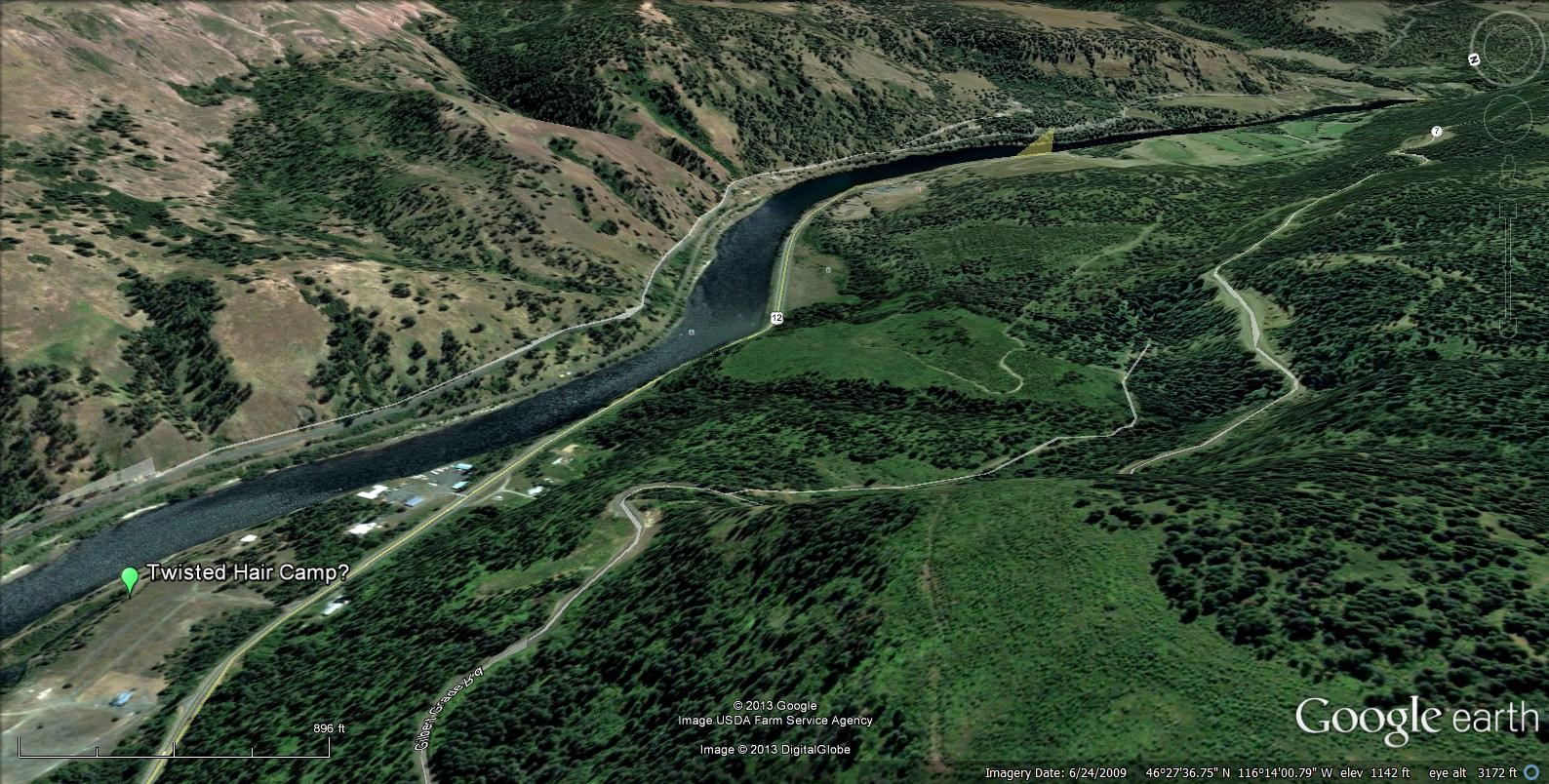
Figure 3. Looking up river from Twisted Hair's Village. The route Capt. Clark would have taken to reach Twisted Hair's camp was about where the Railroad is today. Full-size image
Clark would have approached Twisted Hair’s camp on the north side of the river. There must have been a trail along the river but the railroad and the county road have obliterated it. However, in Figure 3 you can see the rugged natured of the ground. Indian trails were made and maintained by use, not by a trail crew so the route would have been pretty rough. The next day Clark returned to the Weippe area and was given a young horse to ride. The horse threw him three times on the rocky ground and Clark recorded in his journal: this young horse in fright threw himself & me 3 times on the Side of a Steep hill & hurt my hip much....
Orofino River Crossing
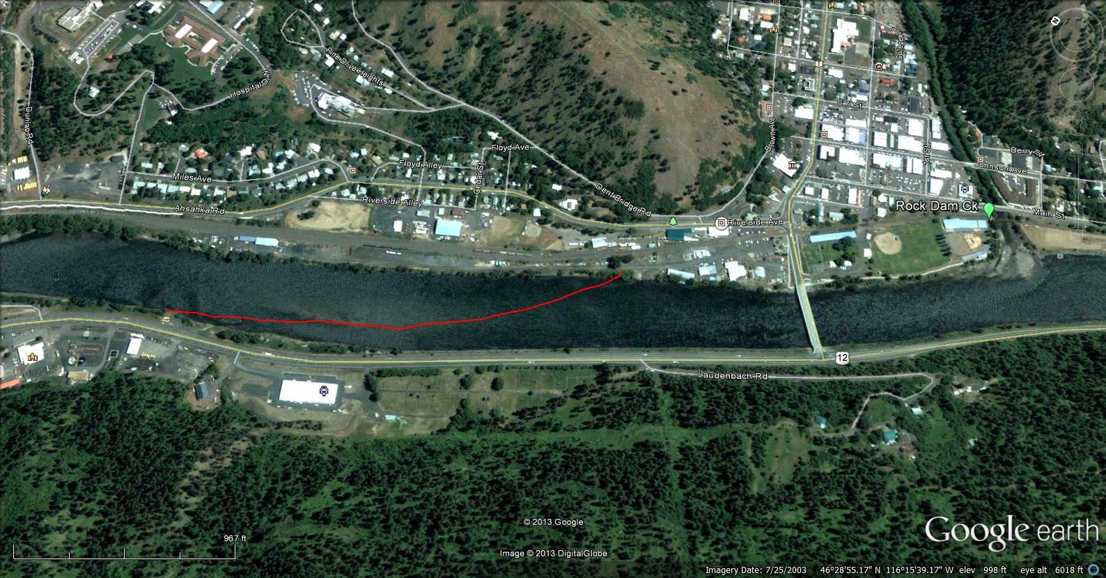
Figure 4. The river crossing was a major point in travel. Google Earth image dated 2003, before Clearwater Crossing RV park was built. Full-size image
In Figure 4, the red line is the route of river crossing used by the NezPerce, the Corps of Discovery and by early white settlers until the first bridge was built. Today the upper end is marked by a statue at the entrance to Clearwater Crossing RV Park and the lower end emerged just above the airport. The Google Earth image was taken with moderately high water, so the sand bars and islands that make the crossing are not visible. In September they are very visible.
Today’s Orofino Creek enters the Clearwater River just upstream from the crossing. Clark called it “Rock Dam Creek.” When the full expedition came down from the Weippe they camped on a small island, now a railroad bed just upstream. To reach Canoe Camp the next day, on September 26th the full Corps of Discovery traveled down the north side of the river across Rock Dam Creek to the river crossing today marked by the statues at the entrance to the RV Park. There they crossed the river and continued west on the south side of the river to their camp near the mouth of the North Fork at what today we call “Canoe Camp.” See Figure 5.
Canoe Camp
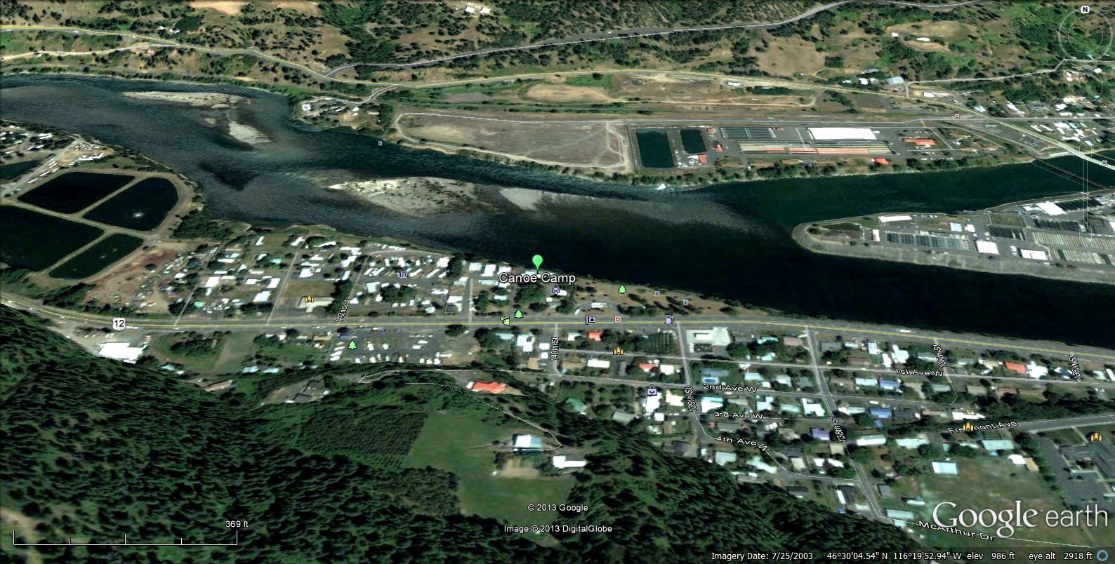
Figure 5. Looking up the North Fork from Canoe Camp. Full-size image
Earlier, Canoe Camp location had been selected by Capt Clark. His journal records the following:
I Set out early with the Chief and 2 young men to hunt Some trees Calculated to build Canoes, as we had previously determined to proceed on by water, I was furnished with a horse and we proceeded on down the river Crossed a Creek at 1 mile from the right very rockey which I call rock dam Creek & Passed down on the N side of the river to a fork from the North which is about the Same Size and affords about the Same quantity of water with the other forks we halted about an hour, one of the young men took his guig and killed 6 fine Salmon two of them were roasted and we eate, two Canoes Came up loaded with the furniture & provisions of 2 families, those Canoes are long Stedy and without much rake I crossed the South fork and proceeded up on the South Side, the most of the way thro’ a narrow Pine bottom in which I Saw fine timber for Canoes...
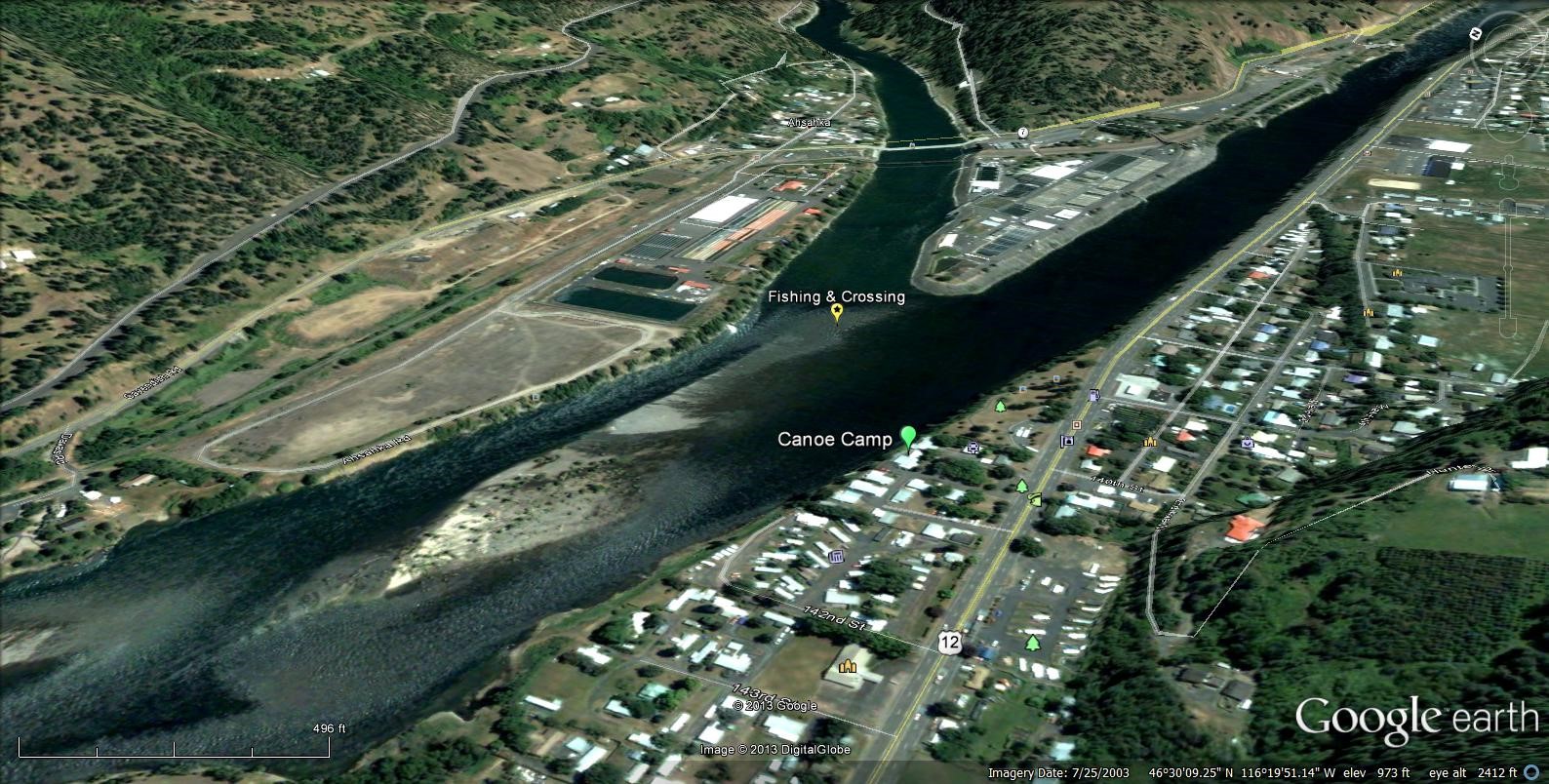
Figure 6. Looking up the North Fork from Canoe Camp. Full-size image
For the Nez Perce, the river not only provided food, but it was a major transportation route. Clark also recorded that one of the Indian Canoes with 2 men with Poles Set out from the forks at the Same time I did and arrived at our Camp on the Island within 15 minits of the Same time I did, not withstanding 3 rapids which they had to draw the Canoe thro'...
This distance is about 5 miles and would have taken about one & half hours on horseback. Today the only boats that go up river are modern jet boats and it takes nearly as long to travel the route.
When visiting the mouth of the North Fork River you can still see the island and the sand bars people used to cross the mouth of the North Fork and to cross to the south bank of the main river. One of the finest views of these L&C sites is from the point of land between the two rivers. To reach it from Orofino travel west down the north bank to the Dworshak National Fish Hatchery and park in their parking lot. There is a self-guided tour of the hatchery that will take you to the point.
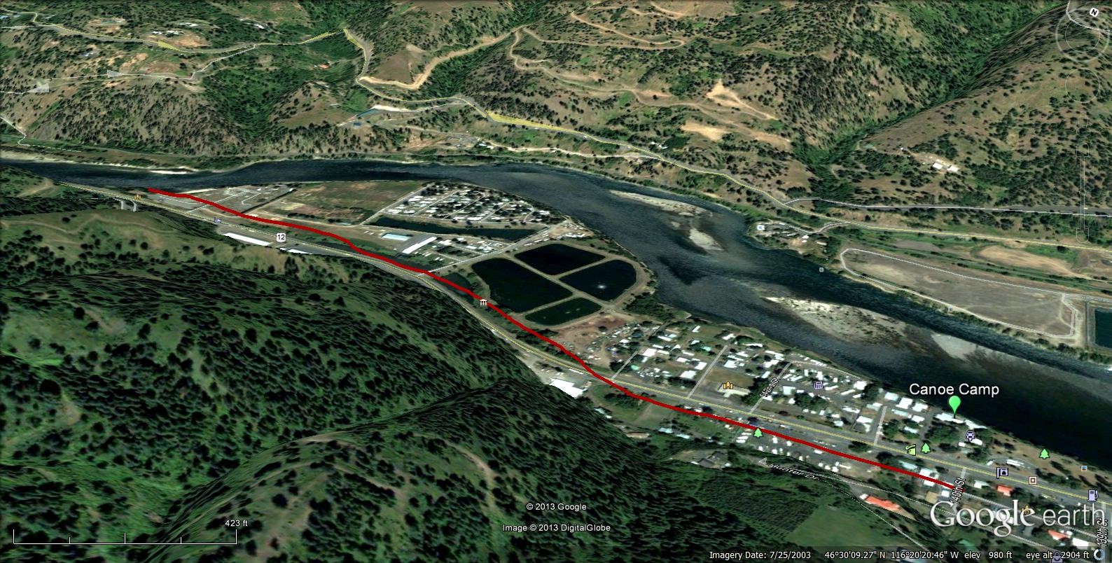
Figure 7. The probable route of the slough and route of the canoes out from canoe camp. Full-size image
The journals record that they were able to see up the North Fork some distance. This has led some people to speculate that their camp was a little further west that where the designated “Canoe Camp” public park is today. Town legend is that the Corps of Discovery cut their canoe trees “behind” camp. At that time there was a slough, or wet area behind the natural levy that provides the open park like setting at today’s Canoe Camp. When the state highway built through this area in the 1930s they removed the stumps of the “Canoe” trees over the objections of local residents. Much of the slough or wet area has been filled but you can still see some low lands just west of Canoe Camp RV Park on the south side of the highway. See Figure 7. It is likely that the canoes were built in or adjacent to this slough, loaded in the water there, and the Expedition entered the main river near today’s “Pink House Hole” campground. White man has greatly modified the landscape here in the last 70 years for farming, homes and sewer treatment ponds.
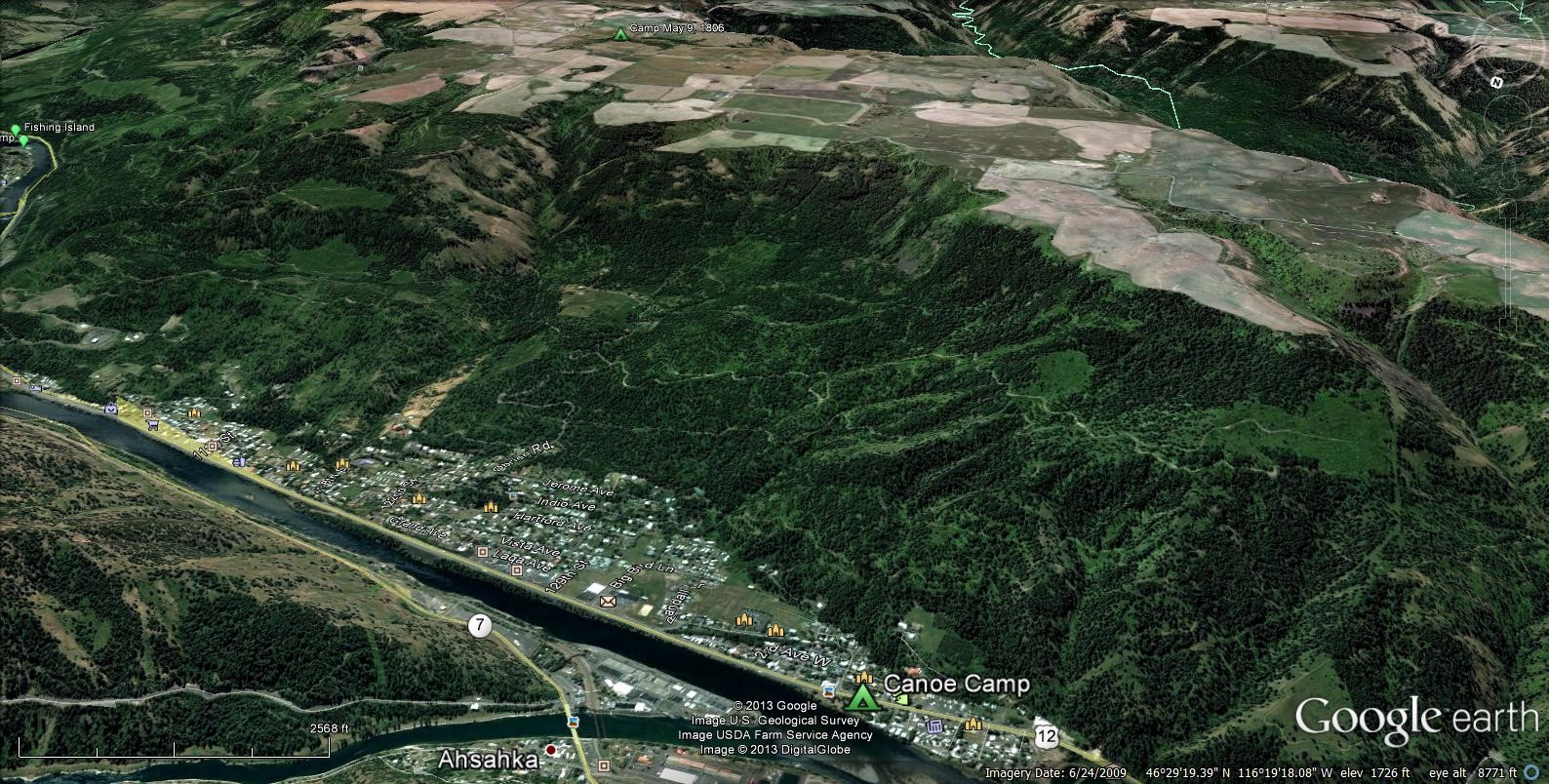
Figure 8. Looking from the north side of the river across at Canoe Camp and the Camp of May 9, 1806 located in the prairie above (in upper center of photo). On May 7, 1806 Willard and Twisted Hair returned to Canoe Camp and collected the cashed gear. The route they followed was not recorded and is open to speculation. Full-size image
The Expedition cashed unneeded gear, probably against the bank of the mountain. When the Expedition returned the next year they followed a trail to the prairie lands two thousand feet higher to the south. They were guided by Nez Perce and on the night of May 9, 1806 they camped a few miles south of Canoe camp. See Figure 8 below. Willard, Twisted Hair and two boys and a pack horse to collect the gear they had cashed.
Note that the weather in those days was as unpredictable as today’s weather. It snowed on them. Capt. Clark recorded 8 inches of snow in camp.